|
| *****SWAAG_ID***** | 959 |
| Date Entered | 02/11/2016 |
| Updated on | 04/11/2016 |
| Recorded by | Tim Laurie |
| Category | Settlement |
| Record Type | Archaeology |
| SWAAG Site | Reeth Low Moor |
| Site Access | Public Access Land |
| Record Date | 16/10/2016 |
| Location | Reeth Low Moor. Cringley Hill, south terrace. |
| Civil Parish | Reeth |
| Brit. National Grid | NY 9958 0059 |
| Altitude | 410m |
| Geology | Chert strata over The Main Limestone |
| Record Name | Prehistoric settlent complex on Cringley Hill |
| Record Description | Settlement complex centred on an ovoid stone banked enclosure 35m*25m overall now masked beneath thick heather. Google Earth Historical Imagery indicates of the presence of a contained round house within this ovoid enclosure.
The settlement complex comprises several circular house foundations located within a number of stone banked paddock-like fields. These enclosures extend across the upper, south facing slope of Cringley Hill. Recent heather burning has revealed that the stone embanked fields extend from the present track from Fore Gill Gate down to the front edge of the terrace above the very steep slope above Fore Gill. The remains of a possible stone ring and other disturbed structures have been recognised within these enclosures. At the time of this re-visit, the area, previously visible to the east of the ovoid enclosure (RTH01 on the attached survey plan, is now under heather. Interpretation should not rule out the possibility that this small oval enclosure could be an embanked stone circle or ring cairn predating the settlement complex, however I consider this site to be best considered as a high elevation settlement complex characteristic of Bronze Age Settlements throughout Upland Britain.
See attached extracts from the EDM SWALB Survey (with additions) and Laurie, White and Mahaffy, 2004, Figure 6.14 Calverside West.
|
| Dimensions | 400m*200m overall approximately |
| Additional Notes | These settlement remains were the first to be recognised in Swaledale during field work which lead to the formation of the Swaledale Land Boundaries Project.
Reduction of sheep numbers and grazing pressure has made recognition of these early landscapes very difficult where masked below heather.
Fortunately , the episodic heather burning does reveal areas of these settlement landscapes as the photos taken recently at Cringley Hill, see below, confirm. |
| Image 1 ID | 7015 Click image to enlarge |
| Image 1 Description | | 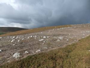 |
| Image 2 ID | 7011 Click image to enlarge |
| Image 2 Description | | 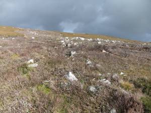 |
| Image 3 ID | 7012 Click image to enlarge |
| Image 3 Description | | 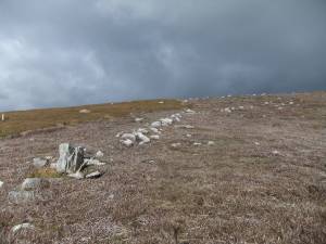 |
| Image 4 ID | 7013 Click image to enlarge |
| Image 4 Description | | 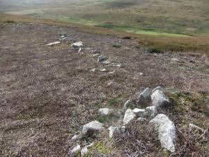 |
| Image 5 ID | 7014 Click image to enlarge |
| Image 5 Description | | 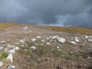 |
| Image 6 ID | 7018 Click image to enlarge |
| Image 6 Description | SWALB (1984-1993) EDM Theodolite Survey of the Early Landscapes of Reeth Low Moor, Western Section. | 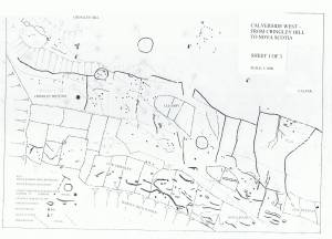 |
| Image 7 ID | 7016 Click image to enlarge |
| Image 7 Description | Settlement remains on Cringley Hill, detail based on this survey | 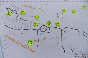 |
| Image 8 ID | 7017 Click image to enlarge |
| Image 8 Description | Settlement remains on Cringley Hill, detail based on this survey. | 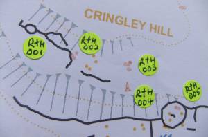 |
| Image 9 ID | 7019 Click image to enlarge |
| Image 9 Description | View over the settlement terrace towards the ovoid enclosure in mid distance. Field boundary and orthostat in foreground. | 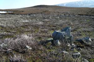 |
| Image 10 ID | 7020 Click image to enlarge |
| Image 10 Description | Early photo of the ovoid enclosure masked in heather. | 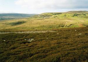 |
| Image 11 ID | 7023 Click image to enlarge |
| Image 11 Description | Ovoid enclosure masked by heather. | 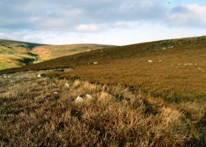 |
| Image 12 ID | 7024 Click image to enlarge |
| Image 12 Description | Ovoid enclosure masked by heather. | 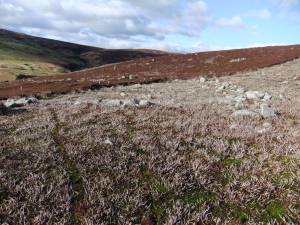 |


